
Authors: Kyle Pimental, Lisa Wise, and Michael Polizzotti
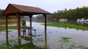
Coastal New Hampshire has historically been shaped by the region’s tidal rivers, the Great Bay Estuary, and the Atlantic Ocean. Working waterfronts and fisheries, historic downtowns, marshes, wetlands, and other regional assets highlight the complementary relationship between the built and natural environments. Together, they help drive the region’s economy by providing recreation and tourism opportunities, as well as benefits for coastal resilience. The New Hampshire Coastal Flood Risk Summary – Part I: Science report, released in late 2025, indicates that coastal New Hampshire is likely to be faced with the implications of climate impacts that will influence local infrastructure, economic development, and municipal investment decisions throughout the region.[i]
The updated report was developed to provide the latest science and projections related to sea-level rise and high tide flooding, coastal storms, groundwater, and precipitation and freshwater flooding. Information in the report is intended to serve as a scientific foundation to support municipalities, state agencies, private businesses, technical assistance providers and professional consultants, residents, and other affected stakeholders to incorporate coastal adaptation and resilience into long-term planning and decision-making.
Coastal flooding in southeastern New Hampshire is typically discussed in the context of the immediate coastline, but in reality, direct and indirect impacts extend much farther inland than most realize. Coastal flood hazards impact tidal rivers, roadways, and important infrastructure that, depending on location and severity, may result in broader regional implications. The report also emphasizes proactive and forward-thinking planning and encourages coordinated adaptation efforts that will help communities prepare for projected coastal flood risks and future climate uncertainty.
Sea-Level Rise and Groundwater Impacts
A key finding of the updated science is that the rate of sea level rise is accelerating. Based on tide gauge data from Seavey Island in Kittery, Maine, relative sea level has risen approximately 8.6 inches over the past century. Projections show that by 2050, coastal New Hampshire is likely to experience 1.1 feet of sea level rise compared to 2000 levels, resulting in more frequent high tide flooding. Further out in the century, there is a larger range in projected sea level rise, depending on global emissions trajectory and the impacts of warming on arctic ice melting. By 2100, relative sea level rise is estimated to range between 3.4 and 4.6 feet, compared to sea levels in the year 2000, though higher or lower amounts are possible.
These new data and projections have direct implications for the economic drivers that define the coastal areas of the state. Many downtowns, recreation destinations, and businesses are located in coastal and riverfront areas that are becoming increasingly vulnerable due to sea-level rise and coastal flooding. Additionally, essential transportation connections, including bridges, culverts, and evacuation routes, may require costly investments and upgrades to withstand increases in frequency and duration of coastal and tidal flooding.
As sea levels rise, groundwater levels are also expected to rise, including in areas beyond the immediate coastline. This expected rise in inland groundwater can inundate low lying areas, damage underground infrastructure such as septic systems, expand new wetland systems, and degrade water quality.
More Intense Storms and Heavier Rainfall
The updated science also indicates that climate change is impacting the intensity of extratropical cyclones like Nor’easters, as well as precipitation patterns across the region. While the total number of these storms is not expected to increase, those that form are likely to be stronger and produce greater total rainfall amounts. Most notably, the report predicts that the frequency of the heaviest rainfall events could double by the end of the century.
These increases in rainfall will likely impact infrastructure that was designed based on historical rates of precipitation, including roads, culverts, bridges, storm and wastewater systems, and utilities throughout the region. The development of many communities along rivers makes the region especially vulnerable if waterways more consistently reach heightened flood levels, as a result of increased precipitation intensity. Additionally, the combined effects of warmer temperatures, changing seasonal patterns of precipitation, more intense rainfall events, and less snowfall in winter contribute to greater risk of drought, even if total annual rainfall amounts rise.
Regional Adaptation and Collaboration
Climate impacts do not stop at municipal boundaries, nor is this an issue only for communities directly on the coast. The information in this updated report underscores the importance of proactive adaptation and regional coordination. Transportation networks, housing and business infrastructure, and utilities are all interconnected. Flooding that impacts one community can disrupt economic activity, transportation networks, and emergency response times in surrounding communities. As climate impacts intensify, strengthened regional collaboration will become even more important. There are numerous local examples of municipal action to prepare for climate impacts, including incorporating climate in master plan chapters, updating floodplain regulations, conducting vulnerability assessments, and supporting outreach and education. There is also a strong foundation for regional collaboration through the NH Coastal Adaptation Workgroup (CAW), a network of representatives of over 40 organizations, agencies, and municipalities, working together to support resilient coastal communities and share resources and lessons learned.[ii]
Municipalities across the region will need to come together in new and innovative ways to improve resilience against climate impacts. Research from the Federal Reserve Bank of Boston in 2022 found that a one-degree Fahrenheit increase in average temperatures results in a 3.2 percent increase in per capital municipal general funds expenditures to respond to climate impacts.[iii] Additional research highlights that investing in preparedness and proactive mitigation efforts are sound investments. The U.S. Chamber of Commerce recently published findings that show for each dollar invested in disaster preparedness saves $13 in economic, damage, and cleanup costs.[iv]
For coastal communities in New Hampshire, frameworks exist in state statute (RSA 36:53-a) to support cooperation between municipalities to strengthen coastal resilience.[v] The collective decisions communities make today towards infrastructure investment, land use, transportation, economic development, and resilience planning will shape how well southeastern New Hampshire can adapt to uncertain future conditions while preserving the assets and character of the region.
This project was funded, in part, by NOAA’s Office for Coastal Management under the Coastal Zone Management Act in conjunction with the NH Department of Environmental Services Coastal Program.



Sources
[i] https://scholars.unh.edu/extension/2287/
[iii] https://www.bostonfed.org/publications/new-england-public-policy-center-research-report/2022/effects-of-weather-on-massachusetts-expenditures-implications-of-climate-change-in-new-england.aspx
[iv] https://www.uschamber.com/security/the-preparedness-payoff-the-economic-benefits-of-investing-in-climate-resilience